high atlas morocco trekking map 1 100 000
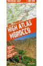
High Atlas Morocco. Trekking Map. 1:100 000
The trekking map of the High Atlas at 1:100 000 includes the region of Jebel Toubkal - the highest peak of Morocco and also the ski station of Oukaimiden. The map also includes a road and tourist map at 1:1 500 000 (1:3 000 000 for Southern Morocco) of the whole country showing tourist attractions. There is also a street plan Marrakech at 1:20 000.
1435 Руб.
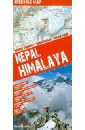
Nepal. Himalaya
This easy-folding laminated map is durable and water resistant. The map includes the region of Everest and Annapurna with detaile topographic and tourist information. The trekking map of the region around Everest is at 1:100 000 scale covering lukla in the south to Gokyo lake in the west, Island Peak in the east and the border with Tibet in the North. The trekking map of the region of Annapurna Dhaulagiri is at 1:150 000 scale. There is also a tourist and road map of Nepal at 1:1 100 000 scale as well as street plans of Kathmandu and Pokara at 1:30 000 scale. The Kathmandu Valley is shown with a 1:100 000 scale map.
911 Руб.

Africa. The Highest Peaks. 1:150 000
This trekking map includes the African peaks that are most popular among avid mountain hikers: Mount Kilimanjaro, Mount Kenya and the Rwenzori Mountains. It covers areas in Kenya, Tanzania and Uganda. A large-scale map with rich tourism content will allow you to plan your trek in detail. Our maps are laminated and easy to fold (due to the Comfort! Map technology), which makes them exceptionally handy even in the harshest mountain weather. Map characteristics: - rich tourism content (including trekking routes, tourist infrastructure, natural attractions and other sights of tourist interest), - exhaustive topographic information (on the roads, hydrographic features, farmlands, forests, glaciers etc., given in extended nomenclature), - shaded relief, representing the area's three-dimensional topography, - GPS compatibility (WGS84 geographic coordinates), - map legend in six languages: English, German, French, Spanish, Italian and Polish. The title comprises maps of the following regions: - Kilimanjaro National Park and Arusha National Park (1:150 000), - area around the Kibo summit of Mount Kilimanjaro (1:50 000), - volcanic massif of Mount Kenya (1:175 000), - top of Mount Kenya - Batian & Nelion (1:50 000), - Rwenzori Mountains National Park (1:100 000), - highest peaks of the Rwenzori Mountains - Margherita & Alexandra (1:50 000). Map legend in six languages: English, German, French, Spanish, Italian and Polish.
2319 Руб.
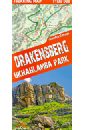
Драконовы горы. ЮАР. Карта 1:100 000 trekking map
This is a unique, handy-in-use trekking map of the Drakensberg in the UKhahlamba Park on the South Africa-Lesotho border. The map stands out for its accurate, detailed topographical and tourism-oriented content. It has been designed especially for enthusiasts of active leisure pursuits who are planning to set off on a trek in the Drakensberg. Produced with the use of the Comfort! Map technology developed by ExpressMap (P), the map is laminated all over, which makes it last longer and ensures that it is exceptionally easy to handle even in the harshest mountain weather. the map covers the whole of the UKhahlamba Park - the highest and the most dramatic area of the Drakensberg rich tourism content (including trekking routes, tourist infrastructure, natural attractions and other sights of tourist interest) shaded relief, representing the area's three-dimensional topography GPS compatibility (WGS84 geographic coordinates) Produced with the use of the Comfort! Map technology developed by ExpressMap (P), the map is laminated all over, which makes it last longer and ensures that it is exceptionally easy to handle even in the harshest mountain weather. Map legend in six languages: English, German, French, Spanish, Italian and Polish.
1544 Руб.
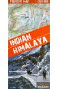
Indian. Himalaya. 1:350 000
A unique map of the Indian Himalaya mountains (scale 1:750 000), detailed maps (scale 1:350 000) of 22 trekking itineraries in 10 regions of north-east India (Kashmir, Ladakh, Zanskar, Lahaul, Rupshu, Spiti, Kinnaur, Garhwal, Kumon and Sikkim), tourist and topographical information and other practical information.
1435 Руб.
Madagaskar
This map appears in the map series world mapping project in travel expertise. Characteristic is the high-quality, clear and modern cartographic representation. Contour lines with elevation Coloured elevation levels Classified road network with distances Places of interest Detailed local index GPS-compatible With graticule Масштаб: 1:1 200 000
823 Руб.
Denmark
This map appears in the map series world mapping project in travel expertise. Characteristic is the high-quality, clear and modern cartographic representation. Contour lines with elevation Coloured elevation levels Classified road network with distances Places of interest Detailed local index GPS capability by longitude and latitude UTM grid Масштаб: 1:300 000
1007 Руб.
Poland, Northern
This map appears in the map series world mapping project in travel expertise. Characteristic is the high-quality, clear and modern cartographic representation. Contour lines with elevation Coloured elevation levels Classified road network with distances Places of interest Detailed local index GPS capability by longitude and latitude UTM grid Масштаб: 1:350 000.
1044 Руб.
Southern Sweden
This map appears in the map series world mapping project ™ in travel expertise. Characteristic is the high-quality, clear and modern cartographic representation. - Contour lines with elevation - Coloured elevation levels - Classified road network with distances - Places of interest - Detailed local index - GPS capability by longitude and latitude - Legend in four languages (Ger., Engl, French Polynesia, Span.) Масштаб: 1:500 000
743 Руб.
Sudliches Afrika. Карта
This map appears in the map series world mapping project ™ in travel expertise. Characteristic is the high-quality, clear and modern cartographic representation. - Contour lines with elevation - Coloured elevation levels - Classified road network with distances - Places of interest - Detailed local index - GPS capability by longitude and latitude - Legend in four languages (. Ger., Engl, French Polynesia, Span.) Масштаб: 1:2 500 000
1423 Руб.
New York. 1:75 000
- super scale map of Manhattan 1:15 000 - map of New York 1:75 000 - places network - street index
548 Руб.
Brooks A. Children`s Illustrated Atlas
DK's Children's Illustrated Atlas brings geography to life; packed with more than 50 colourful maps for kids and fascinating facts about the countries of the world.Each map is bursting with information, such as climates, populations, famous sites, mountains and rivers, and natural wonders of the world. The atlas also includes a world map, with a political map for each continent. Through each map children are shown how to read a map and use a key, compass and scale.Charming and informative, the Children's Illustrated Atlas is a key addition to every child's library. .
1156 Руб.

Vienna. 1:15 000
- places of interest - super scale centre 1:10 000 - map of northeastern Austria 1:450 000 - underground map, street index
743 Руб.

Vienna. 1:17 500
MAP: city plan 1:17 500 & super scale centre 1:11 000, metro map, street index. GUIDE: most attractive sights, travel information, events calendar.
540 Руб.
Budapest. 1:13 000
Budapest laminated city map 1:13 000 Format: 100 x 48 cm, when folded: 11 x 24 cm laminated on both sides, comfortable in making tourist town plan · Detailed 1:13 000 scale (1 cm - 130 m) · Tourist rich content, such as: monuments, museums, hotels, youth hostels and other essential facilities · lines and underground lines and light rail transit · bus, tram and trolley with stops · Shading graphically showing the varied terrain of the city · plan the center of Budapest in a more detailed scale of 1:10 000 (1 cm - 100 m) · Map of the Buda hills and the South Buda in the scale 1:40 000 (1 cm - 400 m) · scheme subway and suburban rail · index to streets
937 Руб.