cyprus zypern 1 150 000
Cyprus. Zypern 1:150 000
This map appears in the map series world mapping project in travel expertise. Characteristic is the high-quality, clear and modern cartographic representation. Contour lines with elevation Coloured elevation levels Classified road network with distances Places of interest Detailed local index GPS capability by longitude and latitude UTM mark on the edge of the map
937 Руб.
Cyprus. 1:200 000
Explore Cyprus with this Freytag&Berndt road map. The best way to plan your trip, prepare your itinerary, and to travel independently on this island in the Mediterrenean. Touristic information: museums, castles, monasteries, churches, mosques, camping sites, caves, archaeological sites, and several inset maps of main cities. The legend is in 4 languages (English and Greek included). Place names are indicated in both Roman and Greek scripts.
937 Руб.
Italien. Superatlas 1:150 000 / 1:400 000
Italien. M 1:150 000 / 1:400 000. Крепление: двойная евроспираль.
1660 Руб.
Montenegro/ 1:150 000
Montenegro. Crna Gora. Road + Leisure Map. 1:150 000 - tourist information - suitable for GPS - index with postal codes
593 Руб.
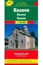
Kosovo 1:150 000
This map appears in the map series world mapping project in travel expertise. Characteristic is the high-quality, clear and modern cartographic representation. Contour lines with elevation Coloured elevation levels Classified road network with distances Places of interest Detailed local index
608 Руб.
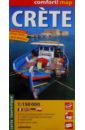
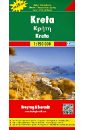
Crete. 1:150 000
laminowana mapa turystyczna 1:150 000 format: 100 x 48 cm, po zlozeniu: 11 x 24 cm Dwustronnie laminowana, wygodna w skladaniu mapa turystyczna Krety bogata tresc turystyczna, m.in.: muzea, zabytki i inne interesujace obiekty (m.in. starozytne miasta, fortece, zamki, grobowce, swiatynie) szlaki turystyczne, kempingi, pola namiotowe parki narodowe, atrakcje przyrodnicze, winnice, gaje oliwne, lasy, zakrzaczenia cieniowanie plastycznie pokazujace uksztaltowanie terenu mapa zgodna z GPS - wspolrzedne geograficzne w ukladzie WGS-84 wszystkie nazwy w alfabecie lacinskim i greckim plany najwazniejszych miast: Chania, Rethymno, Iraklio, Agios Nikolaos, Sitia, Ierapetra
937 Руб.
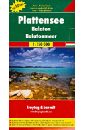
Plattensee. 1:150 000
This road map foldable into a practical format contains detailed information suitable for motorists and other travelers planning to visit the given country or area. The road map features symbols indicating notable tourist attractions and public transportation.
548 Руб.
Peloponnesos. 1:150 000
Folded, fully indexed map of Peloponnesos and Corinth, Greece showing major roads, cities, districts, and political boundaries. Also details the locations of castles,ruins, museums, churches, archeological sites and various points of interest. Additionally, this map also has an insert containing historical and cultural information. Legend is in Greek, German, English, Italian, French, Spanish, Dutch, Czech, Slovak, Hungarian.
937 Руб.
Slovenia 1:150 000
Explore Slovenia with this Freytag&Berndt double-sided road map. The best way to plan your trip, prepare your itinerary, and to travel independently in this country. Top10 Tips: This map includes a Top10 of most interesting sights.
750 Руб.

Sansibar - Pemba - Mafia. 1:100 000 - 1:150 000
This road map foldable into a practical format contains detailed information suitable for motorists and other travelers planning to visit the given country or area. The road map features symbols indicating notable tourist attractions and public transportation.
1160 Руб.
Ямайка. Карта. 1:150 000
This map appears in the map series world mapping project in travel expertise. Characteristic is the high-quality, clear and modern cartographic representation. Contour lines with elevation Coloured elevation levels Classified road network with distances Places of interest Detailed local index GPS capability by longitude and latitude UTM grid.
1423 Руб.
Bavarian Forest 1:150 000
Bavarian Forest. 1:150000. Road + Leisure Map Touristische Informationen. Ortsregister mit Postleitzahlen. Entfernungen in km.
608 Руб.
Dalmatian Coast. 1:150 000
High quality road maps with place name index. In many countries these are simply the best maps available. Scales vary according to the size of the country. Index is in several languages.
1044 Руб.
Canary Islands. 1:150 000
Laminated tourist map 1:150 000 Format: 100 x 48 cm, when folded 11 x 24 cm laminated on both sides, comfortable in submitting the tourist map of the Canary Islands: Tenerife, Gran Canaria, Fuerteventura, Lanzarote, La Palma, La Gomera and El Hierro Tourist rich content, such as: monuments, museums, natural attractions and other interesting objects lava fields, sandy areas, vineyards and other characteristic elements of the landscape of the Canary Islands Shading graphically showing the terrain compatible with the GPS map - coordinates in WGS-84 plans for five major cities: Santa Cruz de Tenerife, Puerto de la Cruz, Las Palmas de Gran Canaria Santa Cruz de La Palma, San Sebastian de La Gomera
937 Руб.
Costa Blanca 1:150 000
This road map foldable into a practical format contains detailed information suitable for motorists and other travelers planning to visit the given country or area. The road map features symbols indicating notable tourist attractions and public transportation.
937 Руб.